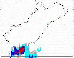
Radar Distribution of Surface water
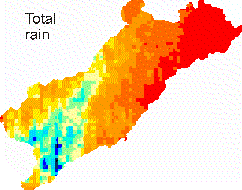
In October 1991 a huge single raincell entered the southern margins of Nahal Zin. Later on a curved squall line developed crossing almost the entire catchment from south to north. Into this main convective rain system inner core cells were embedded with maximum intensities exceeding 200 mm hr-1. Every five minutes the catchment-wide rainfall distribution was recorded by a rainfall radar calibrated by six ground-based rain recorders. However, no completely gauged hydrographs were available, since all gauging stations went out of operation during this high magnitude flood. Hence the non-calibrated model could only be validated by reconstructed peak discharges using the paleoflood technique.
A complete model run yielded hydrographs falling inside the uncertainty range of the field peaks. Moreover the model illustrated that almost the entire catchment generated Hortonian overlandflow and that major tributaries were active reducing the effect of transmission losses. The model showed that one isolated raincell had a deceisive effect on the flood magnitude by postponing the runoff response of an upper tributary to the time of flood arrival in the main channel.
Simulated hydrographs at different locations