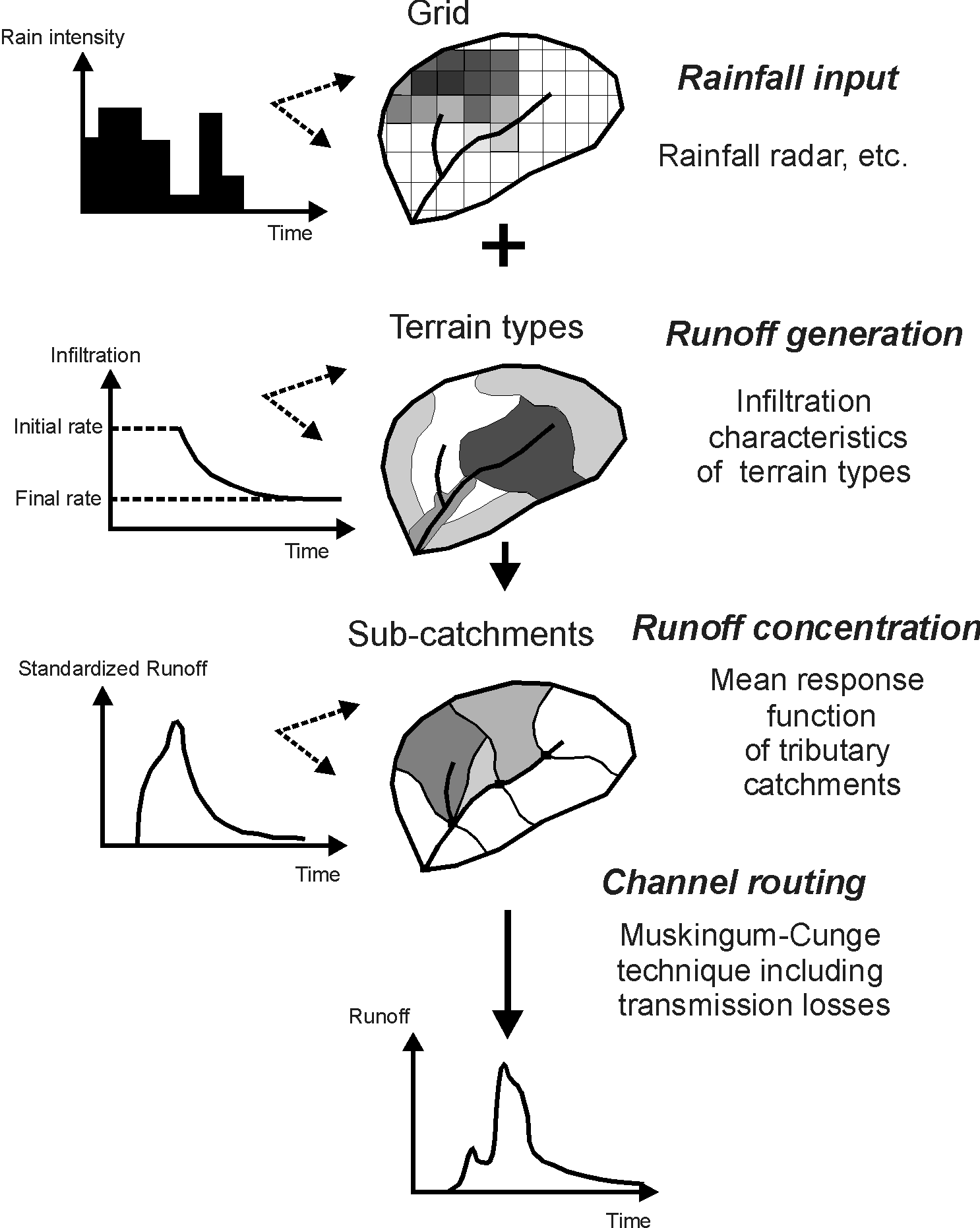
For each dominant hydrological process a separate model routine is passed in succession and for each routine the catchment is subdivided independently. Using adequate techniques (e.g.: GIS-based airphoto analysis, GPS-guided field survey, rainfall radar) all parameters are determined without model calibration.
The model uses spatially distributed rainfall input applied over a catchment which is disaggregated into different terrain types according to hydrologically relevant surface characteristics. Hortonian overland flow generation on each type is parameterized independently using values of initial loss and temporal decay of infiltration determined from existing field experiments. Delimited by topography this catchment wide pattern of rainfall excess is distributed over more than 800 tributary catchments (model elements). Runoff delivery from the model elements to the adjoining channel segments is timed by applying a mean response function determined in an environmentally similar experimental catchment.
Inside the channel network the MVPMC3-method of the Muskingum-Cunge technique is used for streamflow routing accounting for channel dimensions and roughness. For each channel segment a constant infiltration rate is applied to account for channel transmission losses and discontinued when the wetting front reached the bottom of the available alluvial storage.